Ransart, Pas-de-Calais
Ransart | |
|---|---|
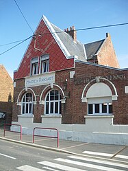 The town hall of Ransart | |
 Coat of arms | |
show Location of Ransart | |
 Ransart | |
| Coordinates: 50°12′36″N 2°41′12″E / 50.21°N 2.6867°ECoordinates: 50°12′36″N 2°41′12″E / 50.21°N 2.6867°E | |
| Country | France |
| Region | Hauts-de-France |
| Department | Pas-de-Calais |
| Arrondissement | Arras |
| Canton | Avesnes-le-Comte |
| Intercommunality | CU Arras |
| Government | |
| • Mayor (2020–2026) | Betty Contart[1] |
| Area 1 | 7.45 km2 (2.88 sq mi) |
| Population (Jan. 2018)[2] | 396 |
| • Density | 53/km2 (140/sq mi) |
| Time zone | UTC+01:00 (CET) |
| • Summer (DST) | UTC+02:00 (CEST) |
| INSEE/Postal code | 62689 /62173 |
| Elevation | 92–141 m (302–463 ft) (avg. 108 m or 354 ft) |
| 1 French Land Register data, which excludes lakes, ponds, glaciers > 1 km2 (0.386 sq mi or 247 acres) and river estuaries. | |


Ransart is a commune in the Pas-de-Calais department in the Hauts-de-France region of France.
Geography[]
Ransart is situated 8 miles (13 km) southwest of Arras, at the junction of the D7 and D3 roads.
Population[]
| Year | Pop. | ±% p.a. |
|---|---|---|
| 1968 | 376 | — |
| 1975 | 346 | −1.18% |
| 1982 | 352 | +0.25% |
| 1990 | 357 | +0.18% |
| 1999 | 374 | +0.52% |
| 2007 | 375 | +0.03% |
| 2012 | 404 | +1.50% |
| 2017 | 404 | +0.00% |
| Source: INSEE[3] | ||
Places of interest[]
- The church of St.Laurent was rebuilt, as was much of the village, after World War I.
See also[]
References[]
- ^ "Répertoire national des élus: les maires". data.gouv.fr, Plateforme ouverte des données publiques françaises (in French). 2 December 2020.
- ^ "Populations légales 2018". INSEE. 28 December 2020.
- ^ Population en historique depuis 1968, INSEE
External links[]
| Wikimedia Commons has media related to Ransart (Pas-de-Calais). |
- Ransart on the Quid website (in French)
This Arras arrondissement, Pas-de-Calais geographical article is a stub. You can help Wikipedia by . |
Categories:
- Communes of Pas-de-Calais
- Arras arrondissement geography stubs