Saint-Inglevert
Saint-Inglevert | |
|---|---|
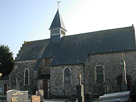 The church of Saint-Inglevert | |
 Coat of arms | |
show Location of Saint-Inglevert | |
 Saint-Inglevert | |
| Coordinates: 50°52′33″N 1°44′37″E / 50.8758°N 1.7436°ECoordinates: 50°52′33″N 1°44′37″E / 50.8758°N 1.7436°E | |
| Country | France |
| Region | Hauts-de-France |
| Department | Pas-de-Calais |
| Arrondissement | Boulogne-sur-Mer |
| Canton | Desvres |
| Intercommunality | CC Terre des Deux Caps |
| Government | |
| • Mayor (2020–2026) | Francis Bouclet[1] |
| Area 1 | 6.6 km2 (2.5 sq mi) |
| Population (Jan. 2018)[2] | 791 |
| • Density | 120/km2 (310/sq mi) |
| Time zone | UTC+01:00 (CET) |
| • Summer (DST) | UTC+02:00 (CEST) |
| INSEE/Postal code | 62751 /62250 |
| Elevation | 85–163 m (279–535 ft) (avg. 123 m or 404 ft) |
| 1 French Land Register data, which excludes lakes, ponds, glaciers > 1 km2 (0.386 sq mi or 247 acres) and river estuaries. | |


Saint-Inglevert is a commune in the Pas-de-Calais department in the Hauts-de-France region of France.
Geography[]
Saint-Inglevert is situated some 12 miles (19 km) north of Boulogne, at the junction of the D244 road with the A16 autoroute.
Population[]
| Year | Pop. | ±% p.a. |
|---|---|---|
| 1968 | 433 | — |
| 1975 | 450 | +0.55% |
| 1982 | 420 | −0.98% |
| 1990 | 502 | +2.25% |
| 1999 | 539 | +0.79% |
| 2007 | 691 | +3.15% |
| 2012 | 733 | +1.19% |
| 2017 | 783 | +1.33% |
| Source: INSEE[3] | ||
Places of interest[]
- The church of St. Barnabé dating from the sixteenth century.
- Traces of an old abbey-hospital.
- Saint-Inglevert Airfield
See also[]
References[]
- ^ "Répertoire national des élus: les maires". data.gouv.fr, Plateforme ouverte des données publiques françaises (in French). 2 December 2020.
- ^ "Populations légales 2018". INSEE. 28 December 2020.
- ^ Population en historique depuis 1968, INSEE
External links[]
| Wikimedia Commons has media related to Saint-Inglevert. |
- [1] Saint-Inglevert Airport
This Pas-de-Calais geographical article is a stub. You can help Wikipedia by . |
Categories:
- Communes of Pas-de-Calais
- Pas-de-Calais geography stubs