Saint-Omer-Capelle
From Wikipedia, the free encyclopedia
Commune in Hauts-de-France, France
Saint-Omer-Capelle
Sint-Omaarskapelle | |
|---|---|
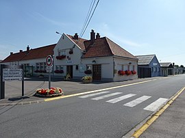 The town hall of Saint-Omer-Capelle | |
 Coat of arms | |
 Saint-Omer-Capelle  Saint-Omer-Capelle | |
Coordinates:  50°56′23″N 2°06′06″E / 50.9397°N 2.1017°E / 50.9397; 2.1017Coordinates: 50°56′23″N 2°06′06″E / 50.9397°N 2.1017°E / 50.9397; 2.1017 50°56′23″N 2°06′06″E / 50.9397°N 2.1017°E / 50.9397; 2.1017Coordinates: 50°56′23″N 2°06′06″E / 50.9397°N 2.1017°E / 50.9397; 2.1017 | |
| Country | France |
| Region | Hauts-de-France |
| Department | Pas-de-Calais |
| Arrondissement | Calais |
| Canton | Marck |
| Intercommunality | CC Région d'Audruicq |
| Government | |
| • Mayor (2020–2026) | Béatrice Boulanger |
| Area 1 | 10.69 km2 (4.13 sq mi) |
| Population (Jan. 2018)[1] | 1,105 |
| • Density | 100/km2 (270/sq mi) |
| Time zone | UTC+01:00 (CET) |
| • Summer (DST) | UTC+02:00 (CEST) |
| INSEE/Postal code | 62766 /62162 |
| Elevation | 1–5 m (3.3–16.4 ft) (avg. 3 m or 9.8 ft) |
| 1 French Land Register data, which excludes lakes, ponds, glaciers > 1 km2 (0.386 sq mi or 247 acres) and river estuaries. | |

Saint-Omer-Capelle (West Flemish: Sint-Omaarskapelle) is a commune in the Pas-de-Calais department in the Hauts-de-France region of France.
Geography[]
Saint-Omer-Capelle is located some 8 miles (13 km) to the east of Calais on the D229 road and just a few hundred yards from the A16 autoroute.
Population[]
| Year | Pop. | ±% p.a. |
|---|---|---|
| 1968 | 538 | — |
| 1975 | 528 | −0.27% |
| 1982 | 698 | +4.07% |
| 1990 | 757 | +1.02% |
| 1999 | 835 | +1.10% |
| 2007 | 1,016 | +2.48% |
| 2012 | 1,121 | +1.99% |
| 2017 | 1,095 | −0.47% |
| Source: INSEE[2] | ||
Places of interest[]
- The church of St.Omer, dating from the eighteenth century.
See also[]
Communes of the Pas-de-Calais department
References[]
- ^ "Populations légales 2018". INSEE. 28 December 2020.
- ^ Population en historique depuis 1968, INSEE
| Wikimedia Commons has media related to Saint-Omer-Capelle. |
show
Communes of the Pas-de-Calais department | |
|---|---|
|
This Pas-de-Calais geographical article is a stub. You can help Wikipedia by . |
- v
- t
Retrieved from ""
Categories:
- Communes of Pas-de-Calais
- Pas-de-Calais geography stubs
Hidden categories:
- Articles with short description
- Short description is different from Wikidata
- Coordinates on Wikidata
- Pages using infobox settlement with image map1 but not image map
- Articles containing West Flemish-language text
- Commons category link from Wikidata
- Articles with BNF identifiers
- All stub articles
- Pages using the Kartographer extension