Wacquinghen
From Wikipedia, the free encyclopedia
Commune in Hauts-de-France, France
Wacquinghen
Wakingem | |
|---|---|
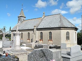 The church of Wacquinghen | |
 Wacquinghen  Wacquinghen | |
Coordinates:  50°47′00″N 1°40′00″E / 50.7833°N 1.6667°E / 50.7833; 1.6667Coordinates: 50°47′00″N 1°40′00″E / 50.7833°N 1.6667°E / 50.7833; 1.6667 50°47′00″N 1°40′00″E / 50.7833°N 1.6667°E / 50.7833; 1.6667Coordinates: 50°47′00″N 1°40′00″E / 50.7833°N 1.6667°E / 50.7833; 1.6667 | |
| Country | France |
| Region | Hauts-de-France |
| Department | Pas-de-Calais |
| Arrondissement | Boulogne-sur-Mer |
| Canton | Desvres |
| Intercommunality | Terre des Deux Caps |
| Government | |
| • Mayor (2020–2026) | Denis Gavois[1] |
| Area 1 | 2.47 km2 (0.95 sq mi) |
| Population (Jan. 2018)[2] | 265 |
| • Density | 110/km2 (280/sq mi) |
| Time zone | UTC+01:00 (CET) |
| • Summer (DST) | UTC+02:00 (CEST) |
| INSEE/Postal code | 62867 /62250 |
| Elevation | 32–96 m (105–315 ft) (avg. 61 m or 200 ft) |
| 1 French Land Register data, which excludes lakes, ponds, glaciers > 1 km2 (0.386 sq mi or 247 acres) and river estuaries. | |

Wacquinghen (West Flemish: Wakingem) is a commune in the Pas-de-Calais department in the Hauts-de-France region of France.
Geography[]
Wacquinghen is situated some 7 miles (11 km) north of Boulogne, at the junction of the D233e and D242e3 roads. The A16 autoroute forms the western border of the commune.
Population[]
| Year | Pop. | ±% |
|---|---|---|
| 2004 | 237 | — |
| 2006 | 233 | −1.7% |
| 2007 | 235 | +0.9% |
| 2008 | 236 | +0.4% |
| 2009 | 238 | +0.8% |
| 2010 | 232 | −2.5% |
| 2011 | 240 | +3.4% |
| 2012 | 244 | +1.7% |
| 2013 | 247 | +1.2% |
| 2014 | 250 | +1.2% |
| 2015 | 255 | +2.0% |
| 2016 | 258 | +1.2% |
Places of interest[]
- The church of St. Antoine, dating from the twentieth century.
- An eighteenth-century chateau.
See also[]
References[]
- ^ "Répertoire national des élus: les maires". data.gouv.fr, Plateforme ouverte des données publiques françaises (in French). 2 December 2020.
- ^ "Populations légales 2018". INSEE. 28 December 2020.
| Wikimedia Commons has media related to Wacquinghen. |
show
Communes of the Pas-de-Calais department | |
|---|---|
|
| show Authority control | |
|---|---|
| General | |
| National libraries | |
This Pas-de-Calais geographical article is a stub. You can help Wikipedia by . |
- v
- t
Retrieved from ""
Categories:
- Communes of Pas-de-Calais
- Pas-de-Calais geography stubs
Hidden categories:
- CS1 French-language sources (fr)
- Articles with short description
- Short description is different from Wikidata
- Coordinates on Wikidata
- Pages using infobox settlement with image map1 but not image map
- Articles containing West Flemish-language text
- Commons category link from Wikidata
- Articles with GND identifiers
- Articles with VIAF identifiers
- Articles with BNF identifiers
- Articles with WorldCat-VIAF identifiers
- All stub articles
- Pages using the Kartographer extension