Wicquinghem
Wicquinghem | |
|---|---|
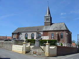 The church of Wicquinghem | |
show Location of Wicquinghem | |
 Wicquinghem | |
| Coordinates: 50°34′35″N 1°57′44″E / 50.5764°N 1.9622°ECoordinates: 50°34′35″N 1°57′44″E / 50.5764°N 1.9622°E | |
| Country | France |
| Region | Hauts-de-France |
| Department | Pas-de-Calais |
| Arrondissement | Montreuil |
| Canton | Lumbres |
| Intercommunality | Haut Pays du Montreuillois |
| Government | |
| • Mayor (2020–2026) | Guy Delplanque[1] |
| Area 1 | 6.8 km2 (2.6 sq mi) |
| Population (Jan. 2018)[2] | 263 |
| • Density | 39/km2 (100/sq mi) |
| Time zone | UTC+01:00 (CET) |
| • Summer (DST) | UTC+02:00 (CEST) |
| INSEE/Postal code | 62886 /62650 |
| Elevation | 106–175 m (348–574 ft) (avg. 117 m or 384 ft) |
| 1 French Land Register data, which excludes lakes, ponds, glaciers > 1 km2 (0.386 sq mi or 247 acres) and river estuaries. | |


Wicquinghem is a commune in the Pas-de-Calais department in the Hauts-de-France region of France.
Geography[]
Wicquinghem is located 12 miles (19 km) northeast of Montreuil-sur-Mer, on the D156 road, 2miles (3k) east of Hucqueliers. Its name is derived from the Flemish Wikingem, which may have its origin in the Viking occupation of the region in the ninth century.
Population[]
| Year | Pop. | ±% |
|---|---|---|
| 2006 | 183 | — |
| 2007 | 183 | +0.0% |
| 2008 | 190 | +3.8% |
| 2009 | 188 | −1.1% |
| 2010 | 203 | +8.0% |
| 2011 | 219 | +7.9% |
| 2012 | 234 | +6.8% |
| 2013 | 239 | +2.1% |
| 2014 | 242 | +1.3% |
| 2015 | 245 | +1.2% |
| 2016 | 249 | +1.6% |
Places of interest[]
- The church of St.Sylvain, dating from the sixteenth century.
- Traces of an old castle.
- The Chapel of Notre-Dame-de-Bon-Secours, dating from the eighteenth century.
See also[]
References[]
- ^ "Répertoire national des élus: les maires". data.gouv.fr, Plateforme ouverte des données publiques françaises (in French). 2 December 2020.
- ^ "Populations légales 2018". INSEE. 28 December 2020.
| Wikimedia Commons has media related to Wicquinghem. |
This Pas-de-Calais geographical article is a stub. You can help Wikipedia by . |
Categories:
- Communes of Pas-de-Calais
- Pas-de-Calais geography stubs