Widehem
Widehem | |
|---|---|
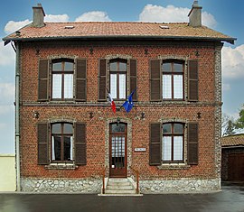 The town hall of Widehem | |
show Location of Widehem | |
 Widehem | |
| Coordinates: 50°35′11″N 1°40′23″E / 50.5864°N 1.6731°ECoordinates: 50°35′11″N 1°40′23″E / 50.5864°N 1.6731°E | |
| Country | France |
| Region | Hauts-de-France |
| Department | Pas-de-Calais |
| Arrondissement | Montreuil |
| Canton | Étaples |
| Intercommunality | Deux Baies en Montreuillois |
| Government | |
| • Mayor (2020–2026) | Pierre Lequien[1] |
| Area 1 | 7.2 km2 (2.8 sq mi) |
| Population (Jan. 2018)[2] | 244 |
| • Density | 34/km2 (88/sq mi) |
| Time zone | UTC+01:00 (CET) |
| • Summer (DST) | UTC+02:00 (CEST) |
| INSEE/Postal code | 62887 /62630 |
| Elevation | 64–178 m (210–584 ft) (avg. 99 m or 325 ft) |
| 1 French Land Register data, which excludes lakes, ponds, glaciers > 1 km2 (0.386 sq mi or 247 acres) and river estuaries. | |


Widehem is a commune in the Pas-de-Calais department in the Hauts-de-France region of France.
Geography[]
Widehem is located 19 km (12 mi) north of Montreuil-sur-Mer, on the D148E5 road, 5 km (3 mi) from the coast.
History[]
Known and recorded as "Wodingahem" in 877, after a Germanic chief of the region who opposed Charlemagne.
Population[]
| Year | Pop. | ±% |
|---|---|---|
| 2006 | 254 | — |
| 2007 | 259 | +2.0% |
| 2008 | 264 | +1.9% |
| 2009 | 269 | +1.9% |
| 2010 | 267 | −0.7% |
| 2011 | 269 | +0.7% |
| 2012 | 261 | −3.0% |
| 2013 | 252 | −3.4% |
| 2014 | 243 | −3.6% |
| 2015 | 243 | +0.0% |
| 2016 | 245 | +0.8% |
Places of interest[]
The neogothic church of St.Wulmer, dates from the sixteenth century.
Widehem is the site of a pioneering 6-turbine wind farm, that opened in 1999.
See also[]
References[]
- ^ "Répertoire national des élus: les maires". data.gouv.fr, Plateforme ouverte des données publiques françaises (in French). 2 December 2020.
- ^ "Populations légales 2018". INSEE. 28 December 2020.
| Wikimedia Commons has media related to Widehem. |
This Pas-de-Calais geographical article is a stub. You can help Wikipedia by . |
Categories:
- Communes of Pas-de-Calais
- Pas-de-Calais geography stubs